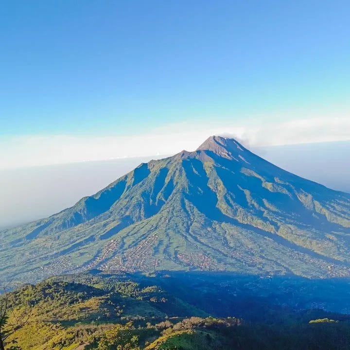
There is a mountain north of Yogyakarta that most travelers walk past on their way to somewhere else. They see it from the road, a broad volcanic dome rising to 3,145 meters above sea level, its slopes green and forested, its summit often hidden in cloud. They photograph it as a backdrop for shots of Mount Merapi next door, the famous active volcano that gets all the attention. And then they drive on.
That mountain is Mount Merbabu, and the travelers who actually climb it consistently say it was the best decision they made in Java.
Merbabu is an inactive stratovolcano sitting on the border of Magelang, Boyolali, and Semarang regencies in Central Java, approximately 30 kilometers north of Yogyakarta city. Unlike its volatile neighbor Merapi, Merbabu last erupted in 1797. Its slopes have had over two centuries to recover, and the result is a mountain covered in dense tropical forest, sweeping open savanna grasslands, and highland meadows that stretch across the upper elevations in a way that makes the summit feel like a completely different world from the hot, busy city below.
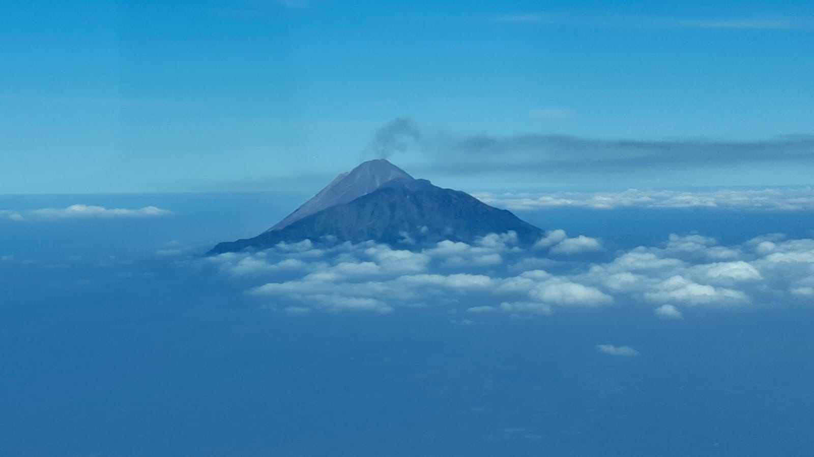
At the top, the panorama is complete. Merapi steams to the south, close enough that you can see the plume rising from its active crater without any visual aid. Sindoro and Sumbing rise to the northwest. Prau and the Dieng Plateau sit to the north. On clear mornings the Java Sea is visible on the horizon in both directions. It is one of the most expansive and complete mountain views in Central Java, and it is earned by one of the most rewarding climbs within reach of Yogyakarta.
This guide covers everything you need before attempting the trek: trail routes, difficulty levels, costs, what to pack, best timing, and how to book.
Before we continue to the main topics, please consider BorobudurSunrise.com if you need tour package in Yogyakarta City. We have an excellent review by Trip Advisor or by Viator. You may check our tour package in this link : Yogyakarta Tour or MountBromoIjen.com. You can also send us an email at [email protected] or just simply contact us by pressing the whatsapp button in the right corner.
What Kind of Mountain Is Merbabu?
Mount Merbabu is a stratovolcano, built layer by layer through successive eruptions over thousands of years into a steep-sided, broad-based profile with a complex summit structure. It has two main peaks: Kenteng Songo at 3,145 meters, the higher and more commonly summited of the two, and Syarif at 3,119 meters. Both peaks sit above a wide summit ridge that gives the mountain its distinctive flat-topped appearance when viewed from Yogyakarta on a clear day.
Despite being classified as inactive, Merbabu sits inside an active volcanic system and is protected as Mount Merbabu National Park, a conservation area covering approximately 5,725 hectares of forest and highland ecosystem. The park shelters endemic Javan bird species including the Javan hawk-eagle, various primates, leopard cats, and a range of highland plant life found nowhere else at this latitude. Trekking through it, particularly in the lower forest sections, you are moving through a genuinely intact mountain ecosystem rather than a degraded trail corridor.
The mountain’s character changes dramatically with altitude. Lower slopes are dense tropical forest, humid and green with filtered light through the canopy. Mid-elevation sections transition into pine and conifer woodland that opens gradually as you gain height. Above the treeline, the terrain shifts entirely into broad savanna grasslands that cover the upper flanks in sweeping waves, golden during the dry season, vivid green in the weeks after rain. The final approach to the summit crosses volcanic rock formations and exposed ridgeline sections that require focus and sure footing but no technical climbing skill.
Merbabu is challenging but not technical. No ropes, no specialized mountaineering equipment, no vertical climbing. What it requires is solid aerobic fitness, appropriate clothing and footwear, a genuine respect for altitude and changing mountain weather, and a certified local guide who knows the route and the conditions.
The Four Merbabu Trekking Routes
Merbabu has four established trail routes approaching from different compass directions. Each has a distinct character, difficulty level, and scenic profile. The right choice depends on your fitness, your available time, and the kind of landscape you most want to walk through.
Selo Route (South) — Most Popular
The Selo route is the standard approach used by the majority of trekkers and most organized tour packages. The trailhead sits at Selo Village in Boyolali Regency, positioned in the saddle between Mount Merbabu and Mount Merapi at around 1,600 meters elevation. This location gives the Selo route something unique among the four options: a direct, close-range view of Mount Merapi throughout the ascent. As you climb, Merapi’s smoking crater rises beside you across the saddle, visible at eye level and then gradually below you as you gain height, its plume catching the light in the morning hours.
The Selo trail moves through savanna grasslands that spread across the southern flank in wide, photogenic sections. The path is well-worn, consistently marked, and benefits from regular traffic that keeps the route clear year-round. Ascent from the trailhead to the summit takes 6 to 8 hours depending on pace and fitness. The designated camping area sits just below the final summit ridge, sheltered from the worst of the wind and positioned for both sunset views to the west and the sunrise push eastward in the early morning hours.
For first-time Merbabu trekkers this is the recommended route. The trail quality, the guide network at the trailhead, and the extraordinary proximity to Merapi throughout make it the strongest overall experience.
Wekas Route (North)
The Wekas route approaches from the northern slope through Magelang Regency, beginning at Wekas Village at a lower elevation than Selo. The northern face of Merbabu is characterized by denser, wetter forest cover in the lower sections and a noticeably more remote atmosphere than the southern trail. Less traffic means quieter trekking, but it also means a greater dependence on a guide who genuinely knows the northern path, as the trail markings are less consistent than on Selo.
The Wekas route is suited for trekkers returning to Merbabu after a first experience on Selo, or for those who specifically want a quieter, more wilderness-oriented ascent where encounters with other trekking groups are rare.
Suwanting Route (West)
The Suwanting route is considered by many experienced Merbabu trekkers to offer the most scenically rewarding landscape of the four options. The western approach passes through particularly dramatic upper savanna sections and delivers wide-angle views of the Central Java landscape that differ substantially from the Merapi-dominated panorama of the southern trail. The Suwanting trailhead sits in Magelang Regency and is conveniently positioned for approach from Yogyakarta.
The trail is steeper than Selo in its upper sections and demands a good base fitness, but the highland meadows in the middle elevation zone are genuinely extraordinary, particularly in the early morning light before the cloud builds. Our team offers dedicated Suwanting route packages for trekkers who want to explore Merbabu’s western face.
Thekelan Route (North)
The Thekelan route begins at Kopeng, a well-known cool highland area near Salatiga in Semarang Regency. The path moves through forest and highland terrain before joining the upper summit section, offering a northern perspective on the mountain that is distinct from both the Wekas and Selo experiences. Kopeng’s established domestic tourism infrastructure means good accommodation options near the trailhead. The Thekelan route is less commonly used by Yogyakarta-based tour operators but is popular among trekkers arriving from Semarang or Central Java’s northern cities.
Read also : Trekking Spot Near Yogyakarta City
Mount Merbabu Day Hike vs Overnight Camping
Merbabu can be climbed as a day hike or as a 2-day 1-night overnight camping trek. The right choice depends on your fitness level, your goals for the experience, and how much physical output you are prepared to sustain in one continuous push.
Mount Merbabu Day Hike
A day hike summit and return is possible but genuinely demanding. The typical departure from the trailhead is between 2:00 and 3:00 AM in order to reach the summit by sunrise. The total round trip covers between 16 and 20 kilometers depending on the route, with a total elevation gain of approximately 1,400 to 1,600 meters from the trailhead. Expect 10 to 14 hours of active trekking. This format suits experienced mountain trekkers with a strong fitness base who have done overnight treks before and specifically want to test themselves on a single-day push.
Day hike entrance fee: IDR 220,000 per person Guide fee (day hike): IDR 800,000 Mineral water, fruits, and snacks: IDR 100,000 per person
Mount Merbabu Overnight Camping 2 Days 1 Night — Recommended
The overnight option is how most experienced trekkers and all first-timers should approach Merbabu, and for very clear reasons. Instead of covering the entire mountain in one relentless push from the trailhead, the overnight format divides the effort into two manageable segments. Afternoon ascent to camp on day one. Summit push and descent on day two. The physical load is spread across two days, the pace is more sustainable, and the experience gained at the high-altitude camp, including the night sky at 2,500 meters and the gradual pre-dawn energy of trekkers preparing for the summit, is something a day hike completely bypasses.
Sleeping at altitude also allows your body to acclimatize slightly before the final push to 3,145 meters, reducing the risk of altitude-related headaches and fatigue at the summit.
Camping entrance fee: IDR 420,000 per person Guide fee (2D1N camping): IDR 1,500,000 Porter: IDR 250,000 Mineral water, fruits, snacks, and breakfast: IDR 200,000 per person
Read also : What is Merapi Lava Tour?
Important: Booking Quota System for Mount Merbabu Trekking
Mount Merbabu National Park operates a strict daily visitor quota system to protect the mountain ecosystem and manage trail safety. A limited number of trekking permits are issued per day through the official registration system. Once the daily quota is filled, no additional trekkers are admitted regardless of how far they have traveled to reach the trailhead.
Walk-in trekking is not an option at Merbabu. All visits must be registered and permitted in advance. During peak season months of July and August, permits fill two to three weeks ahead. During Indonesian national holidays, school holiday periods in June and December, and popular long weekends, the quota fills faster still.
The practical consequence for travelers is straightforward: if Merbabu is on your Java itinerary, treat it as a fixed commitment that requires advance planning rather than a spontaneous activity that can be arranged on arrival. A reputable tour operator handles the permit reservation as part of the package booking, removing this logistics burden entirely. Book early, confirm your permit, and the logistics are handled.

Read also : Ramayana Ballet Prambanan Complete Guide
Sample Itinerary: 2 Days 1 Night Overnight Trek of Mount Merbabu
Day 1
Hotel pickup from Yogyakarta city in the early afternoon, approximately 1:00 to 2:00 PM. Private vehicle drive to the trailhead, around 1.5 to 2 hours depending on route choice. Registration at the national park gate, permit collection, and guide briefing at the trailhead. Begin ascent in the late afternoon, typically 3:00 to 4:00 PM. The first section passes through lower forest, humid and shaded, before the trail opens progressively onto the highland savanna in the fading light. Arrive at the designated camping area, positioned between 2,400 and 2,700 meters depending on the route, by approximately 7:00 to 8:00 PM. Set up tents, eat dinner prepared by the guide, and rest.
The camping area at this elevation on a clear night is an experience in itself. Far from the light pollution of any city, the sky above Merbabu at 2,500 meters is filled with stars. The Milky Way is visible with the naked eye on moonless nights. Temperatures drop to between 5 and 10 degrees Celsius, which is what the warm sleeping bag is for.
Day 2
Wake at 3:00 to 3:30 AM. Final summit push of 1.5 to 2 hours to Kenteng Songo peak at 3,145 meters, covering steep rocky terrain in headlamp light. The darkness and the cold on this section are real: this is the moment that separates trekkers who prepared from those who underestimated the mountain. Arrive at the summit by approximately 5:00 to 5:30 AM. The sun clears the eastern horizon and lights the panorama in stages: Merapi first, then the rolling highland valleys to the south, then Sindoro and Sumbing to the northwest catching the warm early light, then the distant plains of Central Java spreading toward both coasts. Spend 45 minutes to 1 hour on the summit before the cloud builds. Begin the descent by 6:30 to 7:00 AM. Return to the trailhead by late morning, 10:00 to 11:00 AM. Drive back to Yogyakarta, arriving by early afternoon. End of service at your hotel.
Physical Preparation to Hike Mount Merbabu
Merbabu is not a walk in the park. The total elevation gain on the Selo route from the trailhead to the summit is approximately 1,500 meters, covered over 8 to 10 kilometers of ascent. The summit altitude of 3,145 meters is high enough that some trekkers experience mild altitude effects including headache, reduced appetite, and slower thinking, particularly if they have come directly from Yogyakarta at sea level without any acclimatization.
For trekkers with no recent mountain experience, building a fitness base in the weeks before the trek makes a significant difference to the quality of the experience. Regular uphill walking, stair climbing, or running three to four times per week for at least four weeks before the trek builds the aerobic capacity and leg strength that the ascent demands. Trekkers who arrive reasonably fit move at a comfortable pace, enjoy the scenery, and arrive at the summit with energy left. Trekkers who overestimate their fitness often find the final ascent to the summit on day two extremely difficult when reserves are already depleted from day one.
If you have any pre-existing cardiovascular or respiratory conditions, consult a doctor before booking a 3,145-meter trek. Merbabu is demanding at altitude, and the cold pre-dawn conditions add additional stress on the cardiovascular system.
What Is Included in Our Mount Merbabu Trekking Package
Our Mount Merbabu Trekking and Overnight Camping 2 Days 1 Night package includes:
Private air-conditioned transportation with hotel pickup and drop-off within Yogyakarta city. Certified mountain guide with full route knowledge and first aid training. National park entrance permit and registration handling. Camping equipment including tent, sleeping bag, and cooking equipment. Meals at camp including dinner on day one and breakfast before the summit push. Mineral water, fruits, and trail snacks. All parking fees and associated costs.
Not included: Personal trekking clothing and footwear, personal travel insurance, porter service (available at IDR 250,000 if required), and personal expenses.
Ready to Climb Merbabu?
Mount Merbabu is the mountain that experienced Java trekkers recommend to each other and that most Yogyakarta visitors never attempt. The quota system keeps it well-managed and uncrowded relative to its quality. The overnight camping format makes the physical demand sustainable across two days. And the summit panorama at sunrise, with Merapi beside you and Central Java spread in every direction below, is the kind of view that makes the 3:00 AM alarm feel entirely justified.
Book the Mount Merbabu Trekking and Overnight Camping 2 Days 1 Night package here and secure your permit before the quota fills.
Read also : Borobudur Ticket Price
Read also : Prambanan Temple Complete Guide
Read also : Jakarta to Yogyakarta by Train